Pennsylvania · Allegheny Mountains · Mid-Atlantic
Laurel Mountain Ski Resort
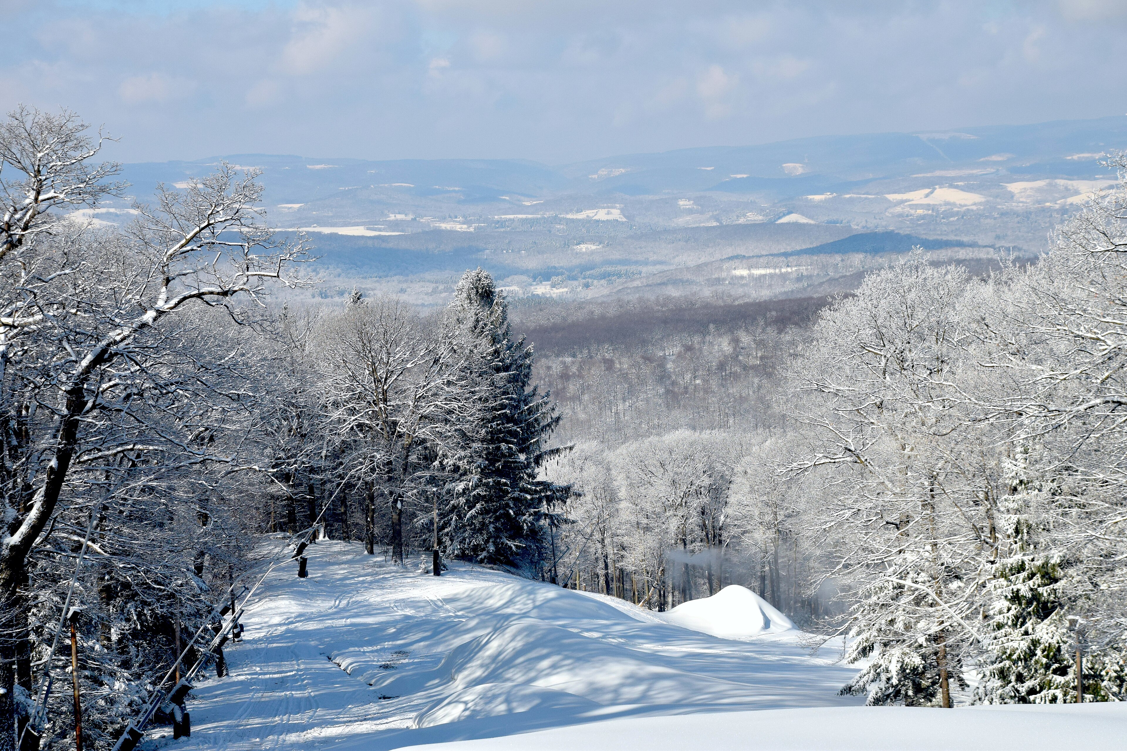
Incredible vistas · Photo: LValleyGirl26 · CC BY-SA 4.0
- Vertical
- Skiable
- Avg. snow
- Not yet collected
Snow
Loading the snow…
Highlights
By the numbers.
The resort rates of its terrain advanced. From the base to the highest lift’s top is , computed from the two, the 182nd most lift-served vertical in the U.S.
Vertical
Average snowfall
Not yet collected
Skiable terrain
Advanced and expert
Computed: the resort rates 16% advanced; no expert share is recorded.
Getting there
31 min from the closest airline airport.
Arnold Palmer Regional Airport, driven on roads without traffic. Nonstops from 1 U.S. cities this past winter.
Arnold Palmer Regional Airport
The closest airport with airline service
Drive, without traffic
By road
1
Nonstop U.S. cities
Pittsburgh International Airport
The nearest well-connected airport
Drive, without traffic
By road
41
Nonstop U.S. cities
Passes
On one pass.
Each pass sells on its own site. Lift tickets sell on the resort's.
Vail Resorts
Epic Pass
Unlimited
Epic Pass 2026-27: Unlimited access to these world-class resorts — Every day of the season, including peak dates.
No pass
Lift tickets
Day tickets are sold on laurelmountainski.com, where the prices are.
Look
See it before you go.
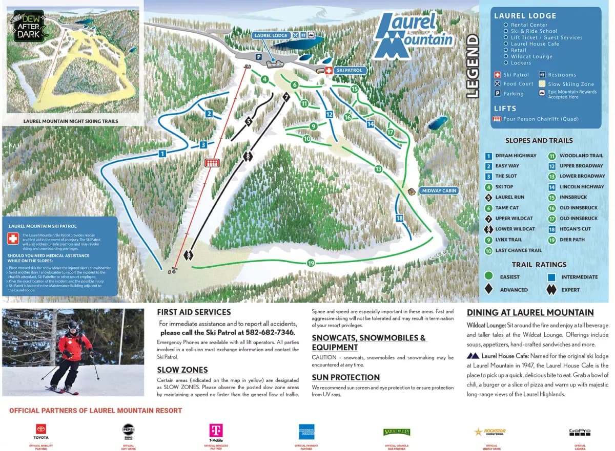
The resort's own trail map, 2 photos and its webcams. Cameras open on laurelmountainski.com.
By trail sign
All 19 runs
Loading the list…
From the resort's own list
- Deer Path
- Innsbruck
- Last Chance Trail
- Lower Broadway
- Lynx Trail
- Old Innsbruck
- Ski Top
- Tame Cat
Yours when you ski it.
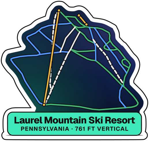
Its place on the map, under the night sky. Mark it skied and it's on your wall.
Map data © OpenStreetMap contributors
Tech specs
Every figure, with its source.
19 figures, each the resort’s own where it publishes one, with its source. Tap a figure for its source and its rank. Ranks are among U.S. ski areas open today.
Mountain
- Summit #4 in Pennsylvania
- Base #4 in Pennsylvania
- Vertical #7 in Pennsylvania
- Lift-served vertical #6 in PennsylvaniaComputed: the highest lift's top minus the base.
- Highest lift #4 in Pennsylvania
- Skiable terrain #13 in Pennsylvania
- Longest run
- Not yet collected
Terrain
- Named trails #13 in Pennsylvania
- Beginner runs #3 in PennsylvaniaComputed: 52% of 19 named trails, both the resort's.
- Beginner
- Intermediate
- Advanced
- Advanced and expert #14 in PennsylvaniaComputed: the resort rates 16% advanced; no expert share is recorded.
- Terrain parks
- Not yet collected
- Night skiing
- Yes
Lifts
- Lifts #24 in Pennsylvania
- Skiers uphill
- Not yet collected
Snow
- Average snowfall
- Not yet collected
- Snowmaking
- Not yet collected
Getting there
- From LBE #3 in Pennsylvania
- LBE, by road
- From PIT #12 in Pennsylvania
- PIT, by road
- From an airport with 12+ nonstops #22 in Pennsylvania
Sources and photo credits17
Sources
- Laurel Mountain Ski Resort, Laurel Mountain Ski Resort — About the Mountain | Laurel Mountain Resort. laurelmountainski.com
- Laurel Mountain Ski Resort, Laurel Mountain Ski Resort — lift tickets. laurelmountainski.com
- Laurel Mountain Ski Resort, Laurel Mountain Ski Resort — official website. laurelmountainski.com
- Pennsylvania Ski Areas Association, Pennsylvania Ski Areas Association — resorts. skipa.com
- Vail Resorts (Epic Pass), Epic Pass 2026-27 resort access (epicpass.com). epicpass.com
- Lift Blog, Lift Blog — Laurel Mountain. liftblog.com
- Wikimedia Foundation, Wikipedia — Laurel Mountain Ski Resort. en.wikipedia.org
- Wikimedia Foundation, Wikipedia — List of ski areas and resorts in the United States. en.wikipedia.org
- aurora.ski, Drive from Arnold Palmer Regional Airport (LBE) to Laurel Mountain Ski Resort, estimated on roads open on 20 January 2027. openstreetmap.org
- aurora.ski, Drive from Pittsburgh International Airport (PIT) to Laurel Mountain Ski Resort, estimated on roads open on 20 January 2027. openstreetmap.org
- Bureau of Transportation Statistics (U.S. DOT), Nonstop flights by route, December 2025 – March 2026: BTS T-100 Domestic Segment (U.S. Carriers) and T-100 International Segment (All Carriers). transtats.bts.gov
- Bureau of Transportation Statistics (U.S. DOT), Passenger boardings by airport, calendar year 2024: BTS T-100 airline traffic (U.S. airlines, domestic flights). geodata.bts.gov
- GMBA Mountain Inventory (placed by aurora.ski), GMBA Mountain Inventory v2.0 (standard): mountain range outlines, with each ski area placed where its runs and lifts are. earthenv.org
- OpenSkiMap.org (OpenStreetMap contributors, Skimap.org), OpenSkiMap — Laurel Mountain Ski Resort. openstreetmap.org
Photography
- Photo: LValleyGirl26 · CC BY-SA 4.0
- Photo: StayLaurel · CC BY 4.0
- Trail map: Laurel Mountain Ski Resort · All rights reserved